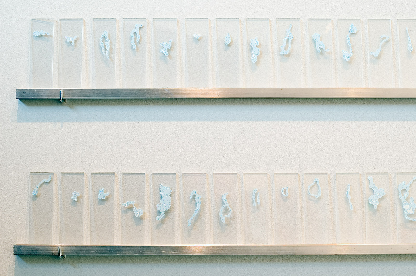
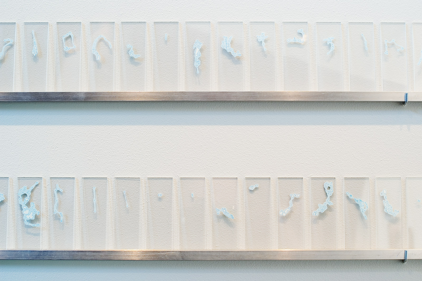
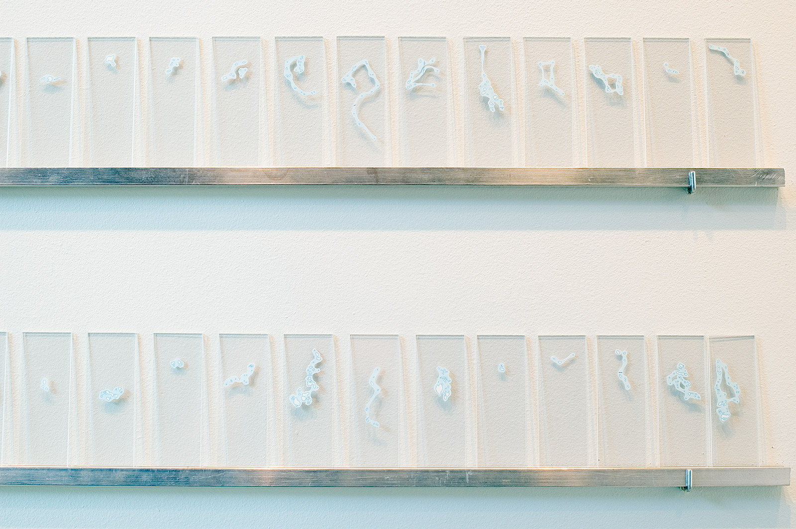
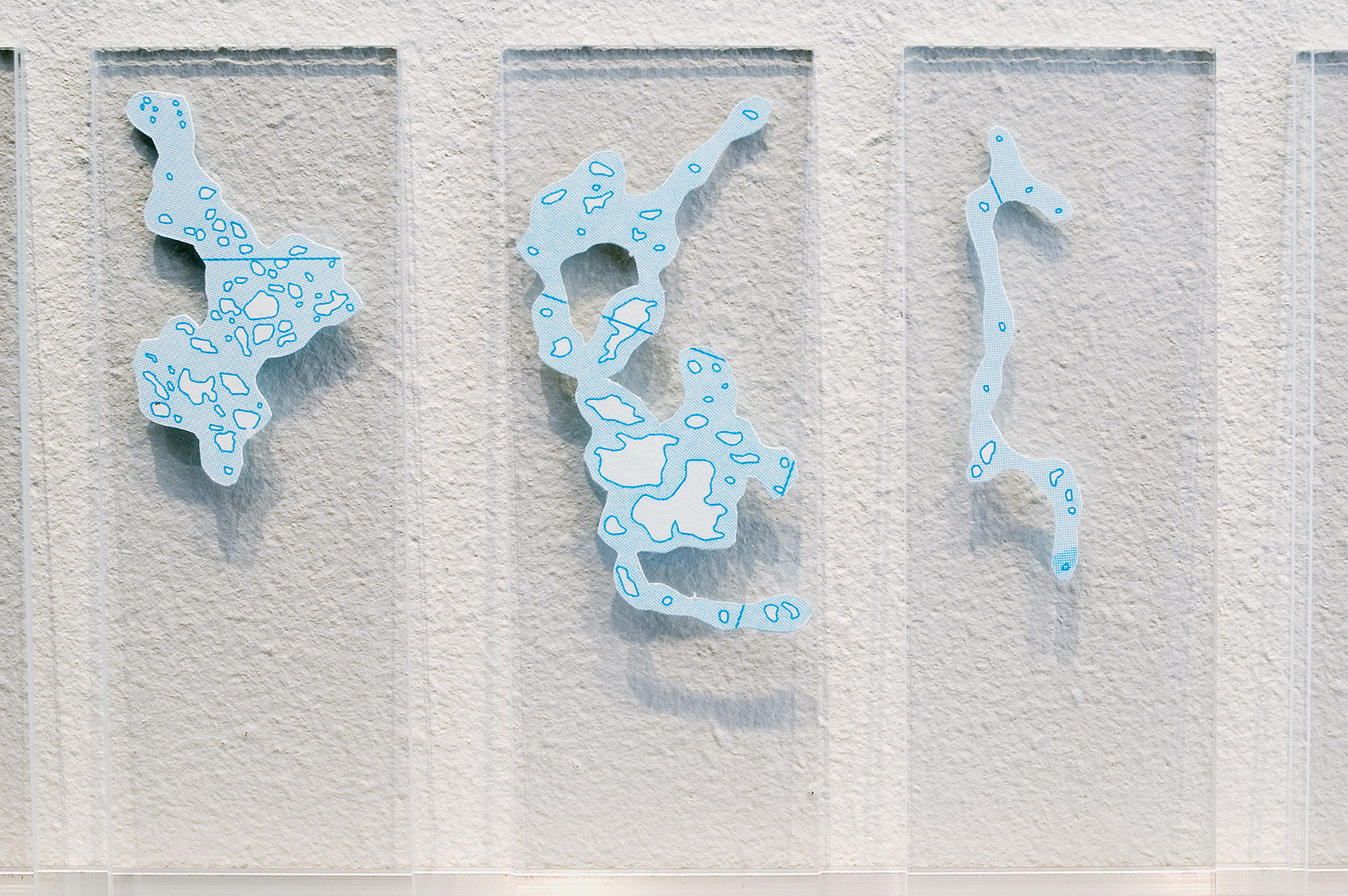
Finland’s Unnamed Islands
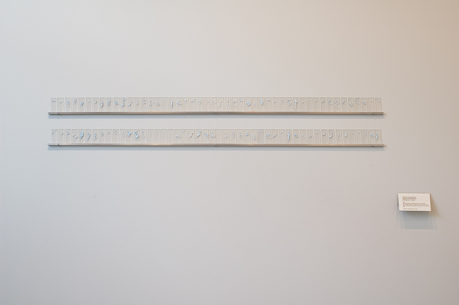
Finland’s Unnamed Islands, 2000. Ninety-six paper map fragments between glass microscope slides on aluminum shelves, dimensions variable.
An enormous world map, about eight feet wide and six feet tall, had pride of place in my childhood home. I’ve spent a lot of time around maps. We always carried sea charts in our family boat Sallywalker while making excursions to uninhabited islands in the outer archipelago in southern Finland, but I pored over these maps indoors as well. Finland has tens of thousands of islands scattered along its southern coast, stretching west toward Sweden, and tens of thousands of lakes in its interior. As a child I imagined that each of Finland’s islands might fit perfectly into one of its lakes—perhaps there was a correspondence that no one had ever noticed, the result of an action like taking a hole punch to the interior and then emptying out the land as islands into the Baltic Sea.
It doesn’t work out that way. There are more lakes than islands, and the two aren’t on the same scale: lakes are often many times the size of Finland’s largest islands. When you look at a map of the whole country, many islands become so small that there isn’t room for the names, so they appear merely as specks and blobs, like cartographic bacteria. I spent a few weeks with a Finnish atlas and an X-ACTO blade, investigating every page as I extracted these unnamed islands. Finally, I placed them between glass microscope slides, arranged in a long line so that they could be read like frames of a film that showed the islands stretching, expanding, and contracting—living forms that could be studied as if under a microscope.