1991-1997
Map Dissection I and II
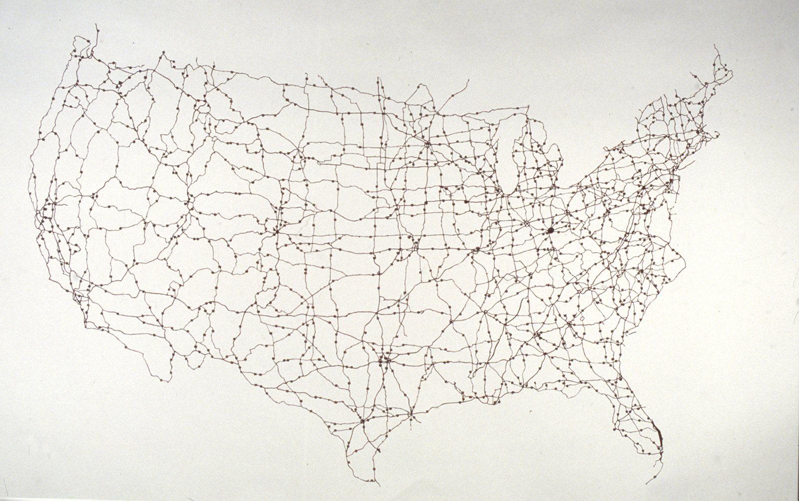
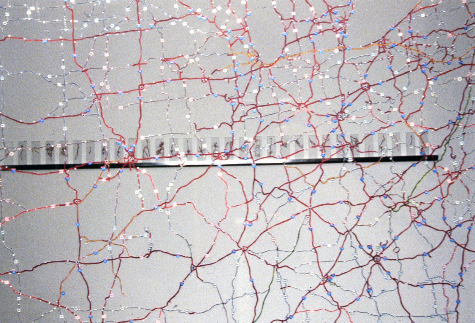
Map Dissection I, 1991/1997. Cut paper map, glass, and hardware, 24 × 36 × 0.5 inches (61 × 91.4 × 1.3 cm).
I dissected a AAA road map of the USA, removing all the land and leaving only the connected road network. The map was sandwiched between two large pieces of glass and suspended at eye height.
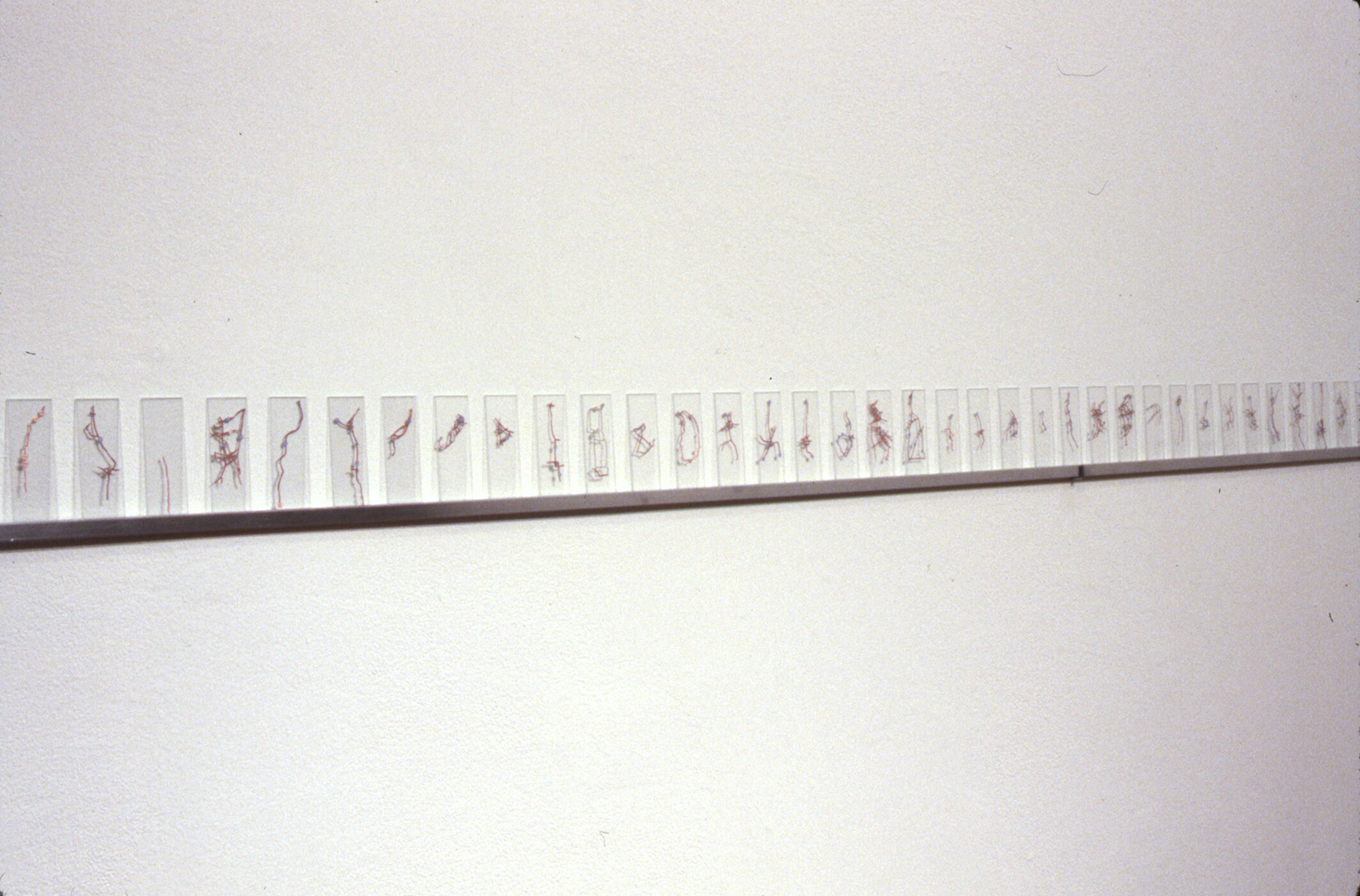
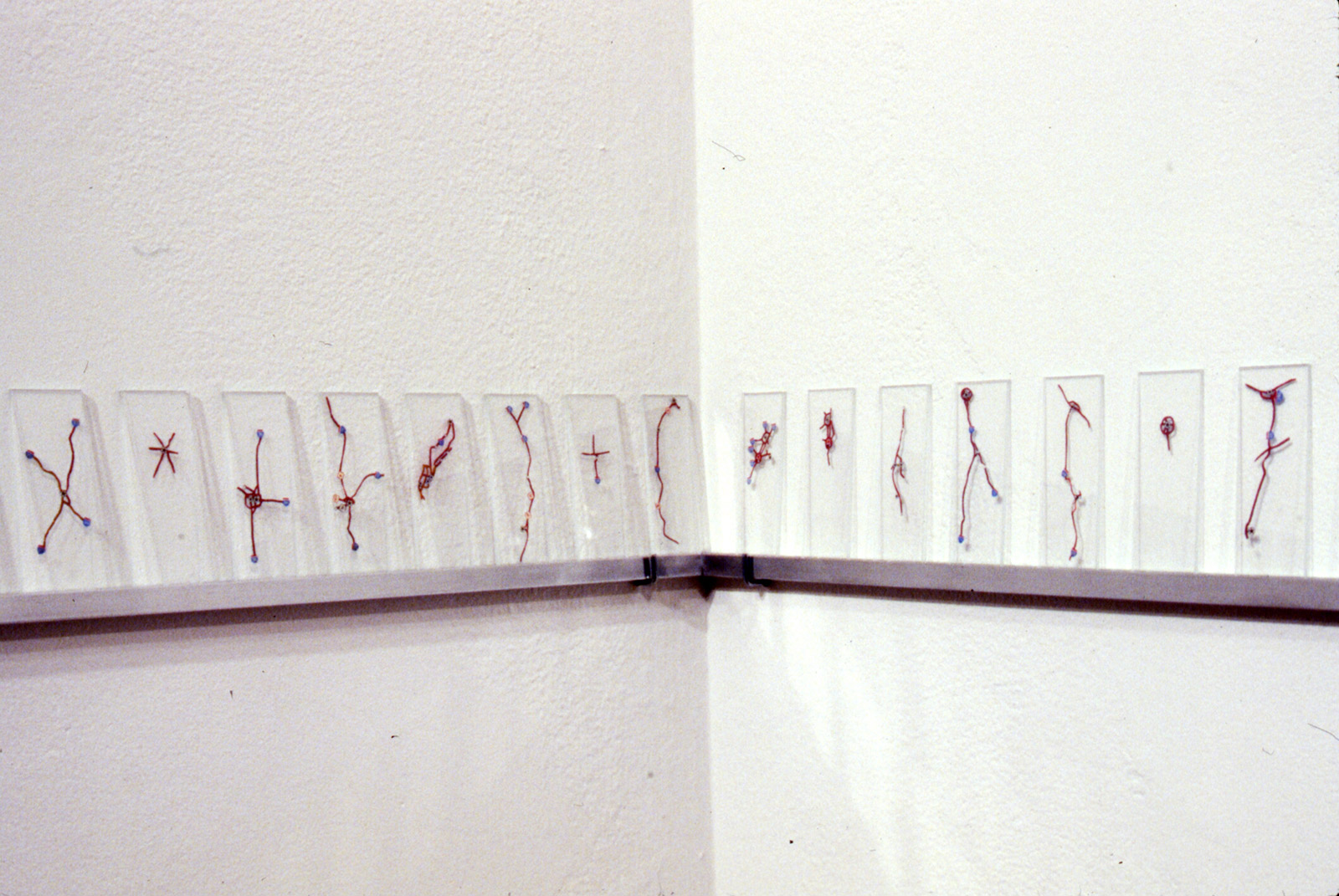
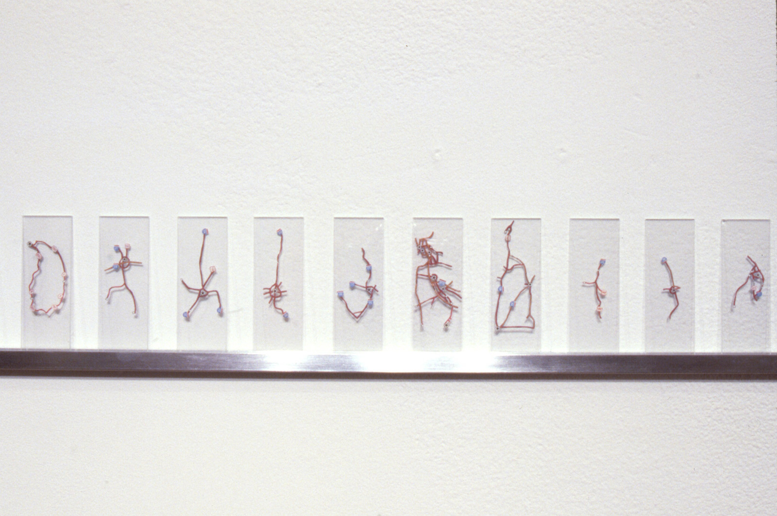
Map Dissection II, 1991. Cut paper map fragments placed between 200 microscope slides (each slide 2 x 0.75 inches) and arranged on 18-foot aluminum shelf.
I performed a second dissection of an identical map, excising the places where roads came together to form small knots or clusters and placing these fragments between glass microscope slides. Many of these extractions became quite figurative.
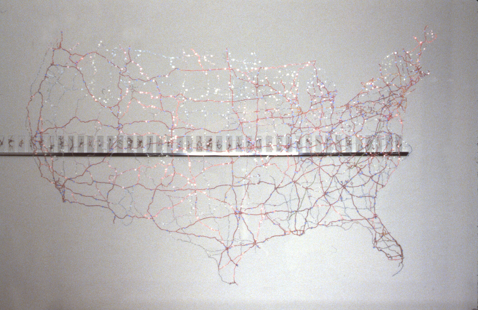
Map Dissection I and Map Dissection II