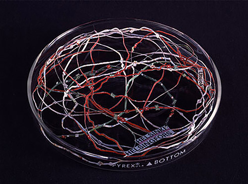
Finland's Longest Road, 2000. Excised paper map fragment in glass petri dish, 6 x 6 x .75 inches.
Finland’s Longest Road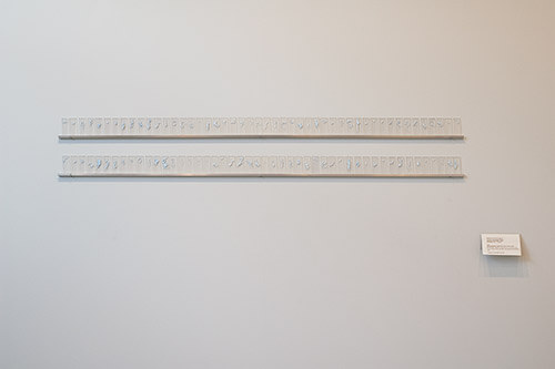
Finland’s Unnamed Islands, 2000. Ninety-six paper map fragments between glass microscope slides on aluminum shelves, dimensions variable.
Finland’s Unnamed Islands
Map of Elgaland/Vargaland, 1997. Excised polyethlyne map between two acrylic sheets. 75 cm × 137 cm × 3 cm.
Map of Elgaland/Vargaland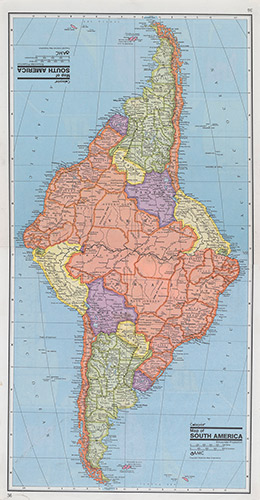
South America from series Geographic Pathologies, 1996. Reassembled paper maps, dimensions variable.
Geographic Pathologies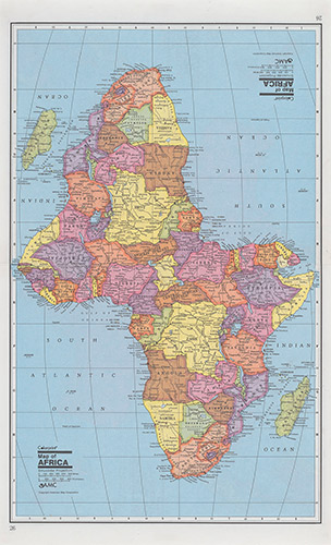
Africa from series Geographic Pathologies, 1996. Reassembled paper maps, dimensions variable.
Geographic Pathologies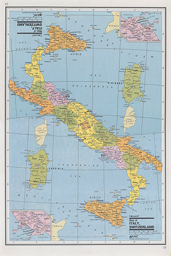
Italy from series Geographic Pathologies, 1996. Reassembled paper maps, dimensions variable.
Geographic Pathologies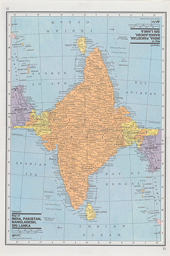
India from series Geographic Pathologies, 1996. Reassembled paper maps, dimensions variable.
Geographic Pathologies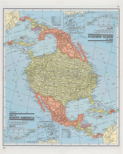
North America from series Geographic Pathologies, 1996. Reassembled paper maps, dimensions variable.
Geographic Pathologies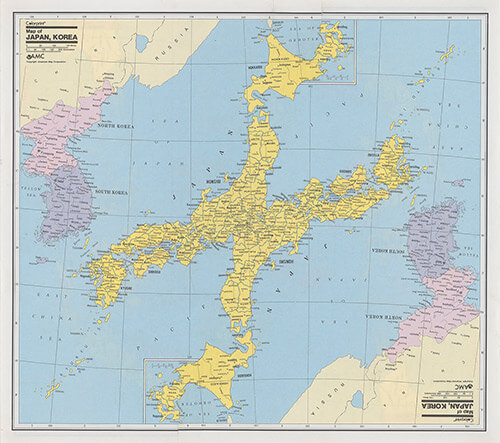
Japan from series Geographic Pathologies, 1996. Reassembled paper maps, dimensions variable.
Geographic Pathologies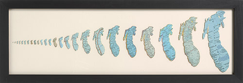
Lake Michigan, 1996. Cut paper, 12 × 35 inches (30.5 × 88.9 cm)
Lake Michigan
World Map II, 1995–96. Cut paper on board, 51 × 36 inches (129.5 × 91.4 cm)
World Map II
Coastal Merger, 1993. Reconstructed paper map on board, 22.5 x 14.75 inches
Coastal Merger
Map Dissection I, 1991/1997. Cut paper map, glass, and hardware, 24 × 36 × 0.5 inches (61 × 91.4 × 1.3 cm).
Map Dissection I and II
Map Dissection II, 1991. Cut paper map fragments placed between 200 microscope slides (each slide 2 x 0.75 inches) and arranged on 18-foot aluminum shelf.
Map Dissection I and II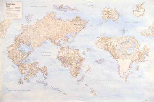
World Map, 1989. Cut paper on board, watercolor, dry transfer lettering, 40 × 50 inches (101.6 × 127 cm).
World Map